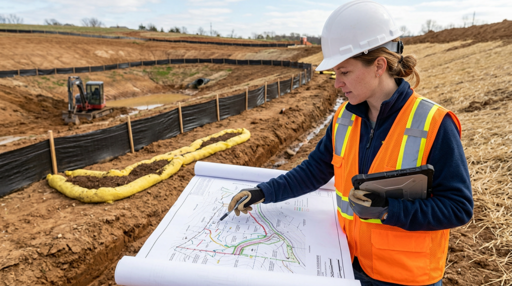
Quick answer: An erosion and sediment control plan explains how you’ll keep soil on your site and out of streets, storm drains, wetlands, and neighboring properties during construction. You usually need one before land disturbance like grading, excavation, utility trenching, or new driveways—especially if a permit is required or the site drains to sensitive areas. The plan typically shows controls, installation timing, inspections, and stabilization steps.
What the Plan Includes in Plain English
An erosion and sediment control plan is a set of drawings and notes that tells contractors exactly where to place temporary controls and how to maintain them as the site changes. It’s not just paperwork; it’s a field playbook that matches the phases of work—clearing, rough grading, utilities, building, paving, and final landscaping.
Plan content and formatting vary by municipality/state and by permit type, but plans typically include a site map with drainage flow directions, limits of disturbance, stockpile locations, a stabilized construction entrance, perimeter controls (like silt fence or compost filter sock), inlet protection, and some form of sediment trapping (like a sediment basin or trap) when space and drainage area warrant it. Notes usually spell out installation sequencing, inspection expectations, repair triggers, and what “final stabilization” means (seed, mulch, erosion control blanket, or pavement) for different areas of the site.
A good plan also calls out trouble spots: steep slopes, long flow paths, concentrated runoff leaving the site, and areas where equipment will repeatedly cross. Those are common locations for washouts and tracking if controls are undersized, installed late, or not maintained.
Common “When You Need One” Decision Checklist
Requirements aren’t universal, but these are common yes/no triggers that often mean an erosion and sediment control plan is required or strongly expected:
Yes/no: Will you disturb soil (clearing, grading, excavation, trenching) beyond a small patch?
Yes/no: Will runoff from your work area reach a street, ditch, catch basin, or other storm drain connection?
Yes/no: Is the project near wetlands, a stream, a pond, or a mapped floodplain, or does it drain toward one?
Yes/no: Are you applying for a building/site permit that includes grading, driveway work, utility work, or stormwater review conditions?
Yes/no: Will exposed soil remain unstabilized for more than a short window because of phasing, weather, or scheduling?
If you answer “yes” to any of these, it’s a sign to ask early what submittals the permitting authority expects so you don’t lose time to revisions.
What Reviewers and Inspectors Commonly Look For
Plan reviewers and field inspectors usually focus on clarity and enforceability: a clearly drawn limit of disturbance, a realistic sequence of installation (controls in before up-slope disturbance), and stabilization expectations that match the phasing. They also look for notes that tell a crew what to do after rain events—inspection timing, maintenance steps, and repair thresholds.
Common rejection or comment themes include missing or inconsistent drainage arrows, controls shown without details or standard notes, no designated stabilized entrance, and unclear responsibility for inspections and maintenance. In the field, failures often trace back to sequencing (fence installed after grading), concentrated flow routed into a perimeter control not meant for it, inlet protection that clogs and causes flooding, or slopes left bare without prompt stabilization.
A practical plan makes it obvious where sediment should be captured, where clean water should be diverted, and how the site transitions from temporary measures to permanent stabilization as areas are finished.
How to Tell If Your Controls Are Working (or Failing)
Working controls look boring: clean streets, clear curb lines, and no sediment fan at the edge of pavement. After a rain, water should pond behind perimeter controls instead of cutting channels around them. Inlet protection should filter water without fully blocking the grate or causing flooding.
Failure signs are easy to spot. Silt fence that’s sagging, buried, or torn; rills and gullies on slopes; muddy runoff leaving the site; and sediment piled in the street all mean the plan or the installation needs adjustment. A stabilized construction entrance that’s tracking mud typically needs more stone, geotextile, or a defined wheel-wash approach.
If you see repeated washouts at the same location, the fix is often about managing flow—adding diversion, shortening slope length, or routing runoff to a trap—rather than just adding more fabric.
A Neutral Next Step Before You Spend Money
If you’re unsure, ask your permitting authority what submittals are required for your project, and whether they want a standalone erosion and sediment control plan, a sheet within a grading plan set, or a broader stormwater package.
If you want help interpreting comments, preparing a plan set, or coordinating the erosion controls with grading and construction sequencing, Haughawout Engineering & Markets is one local option to contact.